Geography and landscape
Valli Cupe Natural Regional Reserve is located in the heart of Presila of Catanzaro, which roughly coincides with the south-eastern sector of the Sila massif. It represents the last extension of the Sila Mountain which extends into the hilly crown reaching the narrow coastal strip that overlooks the Ionian Sea, right in the middle of the wide Gulf of Squillace.
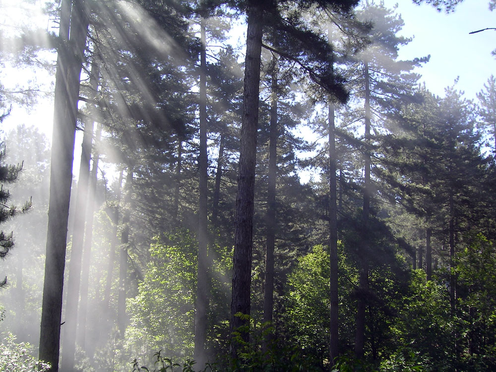
The particular exposure, connected with the proximity to the sea, determines the presence of numerous microclimates with a high level of differentiation at local scale and of a particularly rich and variegate vegetation.
In the part affected by more markedly Mediterranean climatic conditions, the physical environment of the Presila is characterized by the presence of very steep slopes, gorges and deep chasm, where the various watercourses – which form a series of jumps and waterfalls – create habitats unique because of the very particular microclimates that the environmental conditions contribute to establish.
On the phytoclimatic point of view, the territorial strip taken into consideration falls under the area of “Lauretum” (from the hot sub-area to the cold sub-area) – where the climax phase is represented by the holly oak plantations and oleo-lentiscetum along with their variations – in addition to the area of “Castanetum” and the one of “Fagetum”.
The richness of species, which is an indicator of high biodiversity, represents a majestic environmental resource and it makes the area particularly interesting from the naturalistic point of view. Moreover, it is easy to identify elements that make the area similar to the Aspromonte Massif and Serre territory (area dominated by hills and uplands) and for other aspects it reminds of the mountains of the group of Pollino, a remarkable result of different environments, admirable synthesis of the extraordinary natural beauties whose the whole Calabria is rich.
From the geological point of view, the Reserve area is part of the Sila Mountain, which is the highest structural element of the northern sector of the Calabrian-Pelorite arch. The geological matrix is constituted by a granitic-crystalline base, highly metamorphosed. The granites, in fact, are almost always affected by intense processes of alteration that make them inconsistent enough to often assume a sandy particle consistency.
The area is characterized by the clear prevalence of metamorphic rocks (phyllites, shale and gneiss). The igneous terms are mainly represented by rocks with variable composition (quartz-diorite, quartz-monzonite and granite). In some areas pink granite banks emerge, like Mount Raga – an extention of the Sila Mountain that stretches towards the Ionian Sea, until the sedimentary phase that fasten to the slopes of the Sila massif and consists essentially of conglomerates and sandstones of the miocene and pliocene. Approaching the coastal strip, limestone banks and clays along with badlands formations are also present.
The morphology of the places is often very rugged, with steep or very steep slopes. In correspondence with the formations of conglomerates and sandstones, intense erosive phenomena can take place and sometimes they give rise to the formation of spectacular canyons, absolutely unique in our country by geological type.
The territory of the Catanzaro area is strongly irregular due to a continuous sequence of ridges and valleys. This is the result of the excavation action that the waters of rivers and streams have exerted on the sloping slopes since they descend from the Sila Massif towards the narrow coastal strip and the sea.
There are numerous watercourses, different in flow rate and size, but all capable of arousing the interest of naturalists and hikers because of the extraordinary atmosphere that surrounds the wild flow of always limpid waters and incredibly harmonious loud sounds.
Considering the rivers, even the ones with the longest courses always have a torrential shape, with a very variable flow depending on season and rainfall. On the whole, however, the waterways of the area constitute an efficient natural plumbing system, able to regulate the meteoric outflows and at the same time to maintain a substantial water balance in the territory.
A distinctive trait that makes this territory certainly attractive is the presence of a large number of small but suggestive waterfalls, not only along the main water courses but also along the minor ones. This is given by the sudden differences in altitude that affect the bed of rivers and streams in a territory characterized by steep slopes and a discontinuous morphology.
The slow and persistent erosive action of waters which has been taking place over the millennia is also due to the presence of gorges and canyons of extraordinary beauty, sometimes unique in Europe for their peculiar geological features. They are real naturalistic treasures, adorned with lush green vegetation and able to amaze any observer, where the water and the sheltered position contribute to create very special microclimates that make the growth of rare plant associations and surprising biodiversity supply possible.
The climate refers to the cold temperate type in the part of the territory located at an altitude above 800-1000 meters above sea level, with average annual rainfall of more than 1,200 mm., frequent snowfall in winter and average annual temperatures below 15 ° C. At lower altitudes, however, the climate assumes markedly Mediterranean characteristics with average annual rainfall between 800 and 1.100 mm, occasional snowfall and average annual temperatures above 15 ° C.
However, it is worth highlighting that besides the general climatic types quoted above, very particular microclimates can often occur, although they are limited to very restricted territorial areas. In some cases they can refer to a sub-tropical climate that makes the presence of plant associations and species possible, even when not expected to.
As regards the landscapes, the element that most characterizes the Reserve is certainly the extreme variability of environments that suddenly change from an area to another, very similar to a sort of kaleidoscope containing colors and images so that it would be impossible to observe in such quick sequence.
In the area of the Reserve it is possible to admire the same sequence of vegetation bands that one could observe travelling all over Italy from the south to the north, from Sicily to the Alps. In fact, by referring to Pavari’s phytoclimatic classification, it happens to move from Lauretum (olive tree region) to Castanetum (chestnut region) and then to Fagetum (area of maximum diffusion of beech).